Hunting NJ’s mysterious drones in the field with Enigma's AR Identify Lens and Radio Frequency
The “drone” frenzy in New Jersey in late 2024 has left many baffled. Despite a recent statement by the FAA that all drones were "authorized," based on our ongoing meetings with authorities who continue to investigate, as well as the FAA's own actions to restrict airspace activity, we know there is more to the mystery.
At Enigma, we build tools to empower the public to investigate aerial anomalies. We have hundreds of thousands of skywatchers now in our network, and we received a flood of 800+ reports from the public during the the drone activity (read these accounts from our skywatchers here.)
Below is a chart showing the general distribution of the reports we received. Two points to note: 1) we received reports before the media coverage started in earnest. ie. there was genuine activity before there was any "copycat" activity or noise, ie. people flying hobbyist drones. And 2) when the FAA instituted a drone ban Dec 20th, we did see a 44% drop in activity, however some activity persisted.
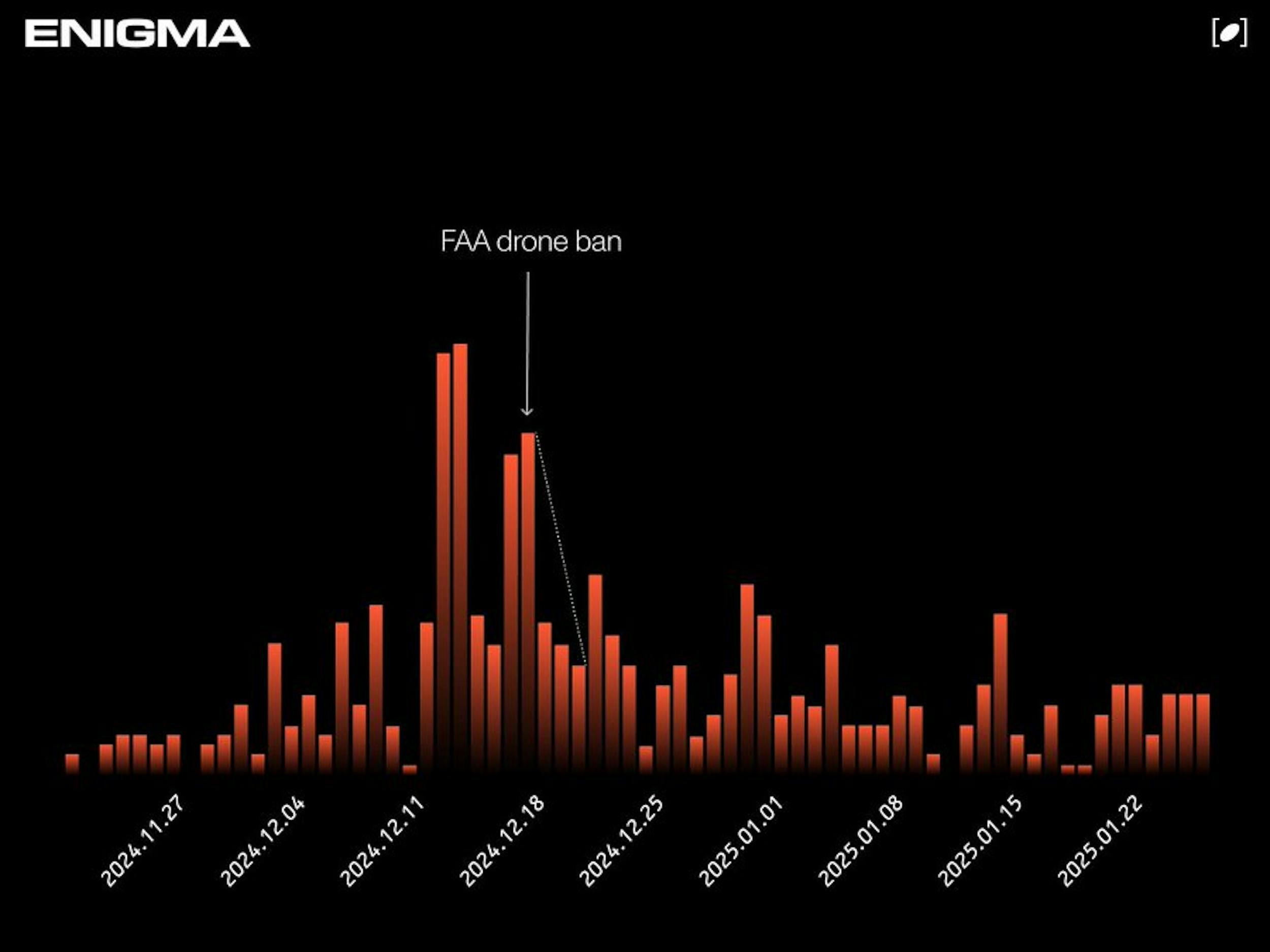
Enigma unidentified aerial object sighting reports in the Northeast, Nov December 2024
Team Enigma is driven by scientific rationalism as well as pursuit of truth. This means we are obsessed with being on the ground and in the facts and data. Interesting findings in our sightings data:
- Many witness accounts described truly unusual objects that were not small or hobbyist drones, some were described as “the size of a bus” or a “car”. 17% of aerial sightings describe large objects.
- 25% of reports describe objects moving in swarms of 5 or more
- 54% of reports describe the objects as "hovering" or staying airborne for long extended periods of time, far beyond the capability of a hobbyist drone.
- 82 unique sighting reports occurred within 5 miles of military sites, including Picatinny Arsenal, Naval Weapons Station Earle, Fort Hamilton, and Fort Monmouth.
It's important to us to also be in the field gathering information, and understanding the experiences of our skywatchers and sighters. So in mid December we decided to do a field trip during the frenzy to investigate – were these actually drones? If so, what type? And who was controlling them?
We teamed up with Distributed Spectrum, a talented team focused on portable Radio Frequency (RF) sensing and signal processing. Our goal was to detect and document these unmanned aerial vehicles (UAV) using both optical sensors (Enigma) and RF sensors (Distributed Spectrum).
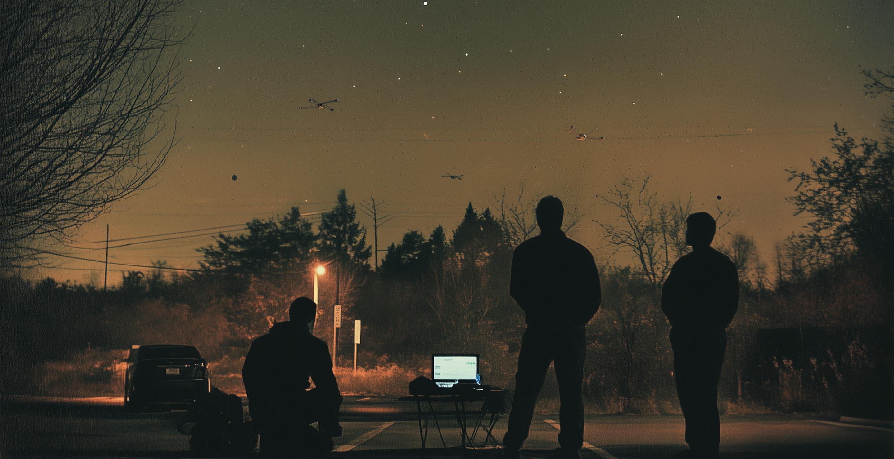
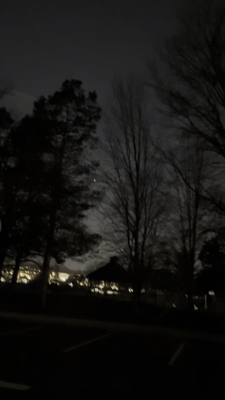
Our heads of engineering and data science drove to New Jersey. We began skywatching around 8:30 PM local time near Edison, NJ. To filter out satellites, stars, and commercial planes, we used the Identify Lens, our augmented reality lens in the Enigma app:
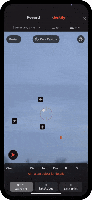
Enigma AR Lens identifies known objects in the sky
The Identify AR tool was essential; without it, we would have wasted time chasing ordinary airplanes. Meanwhile, Distributed Spectrum set up their RF station to scan for unusual emissions using their real-time signal processing software.
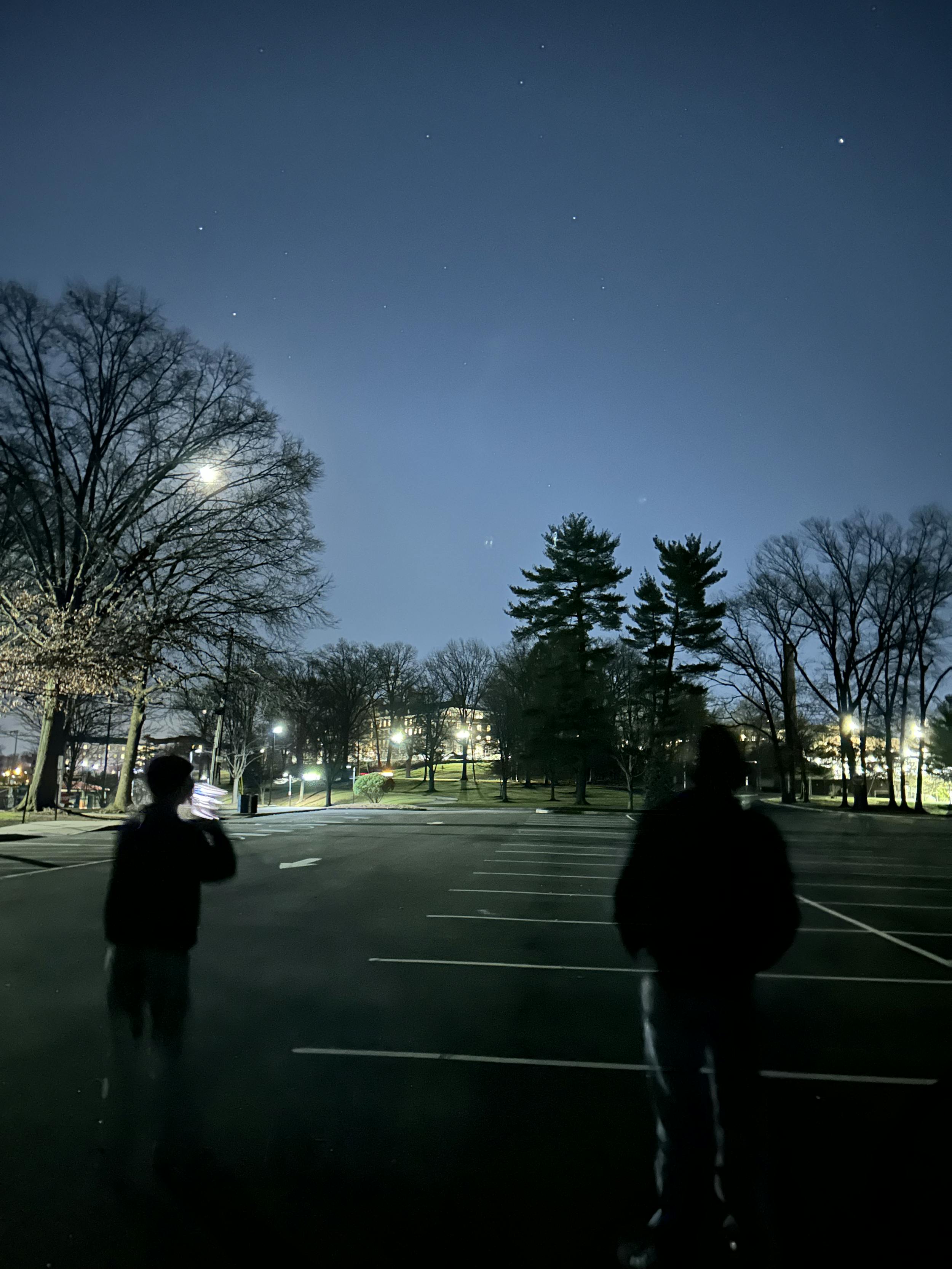
Team members skywatching. The white lights in the sky were commercial planes and stars.
After about 30 minutes, we decided to relocate in search of better vantage points. We used the Alert Network in the Enigma app to analyze where larger concentrations of sighting reports were coming in in real-time. Our teams continued scanning both visually and electronically for any signs of UAV activity.
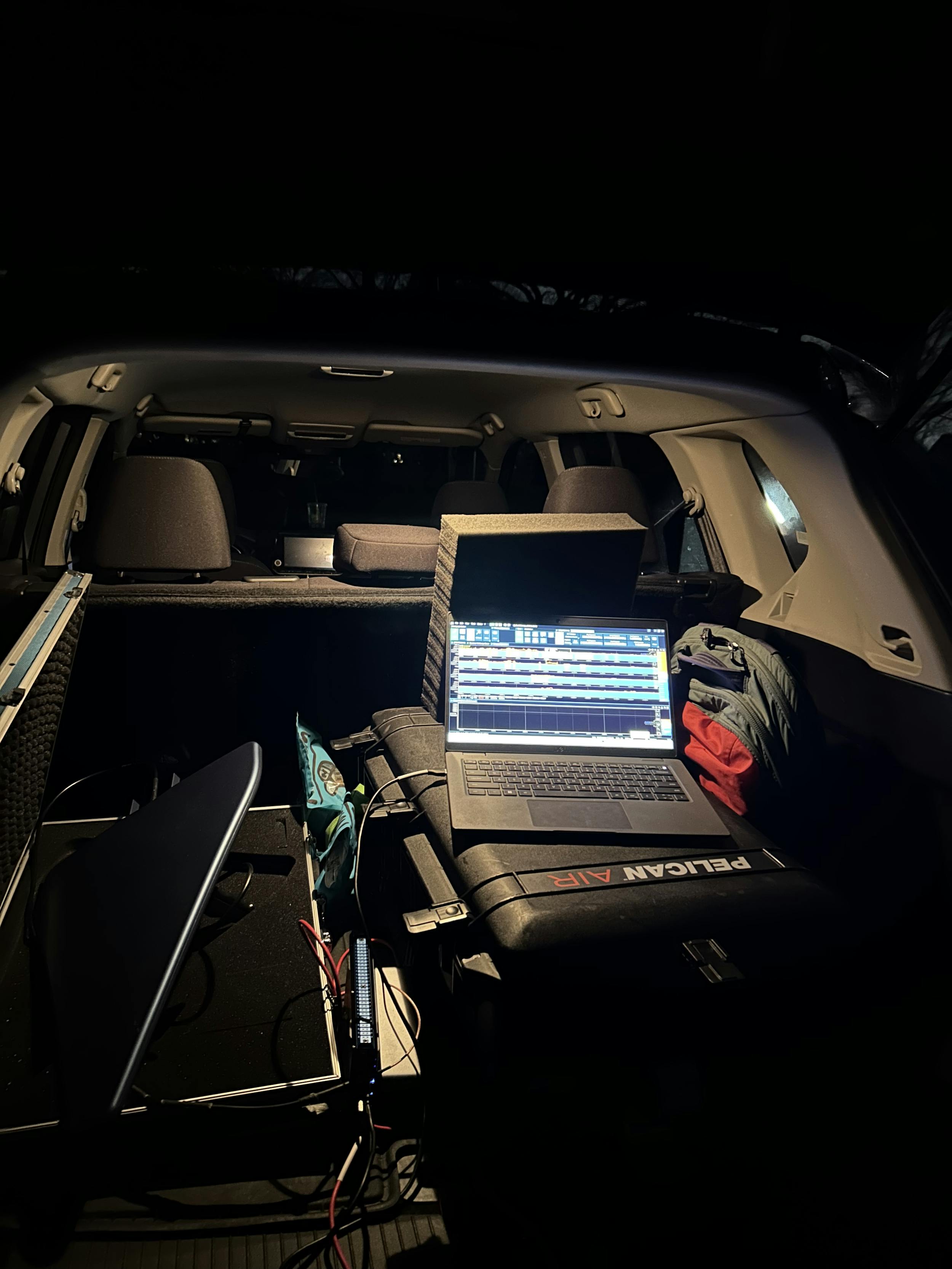
Distributed Spectrum’s Radio Frequency setup.
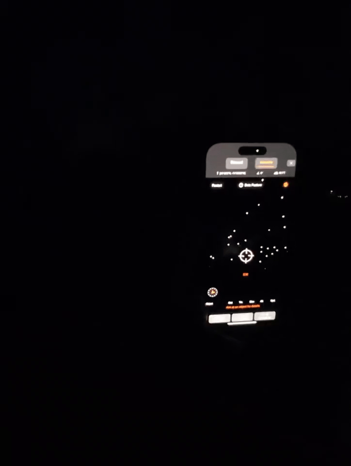
Enigma team using the Identify Camera to filter known aerial activity.
Although we didn’t detect any super interesting anomalous drones that night, but the field test reinforced key takeaways:
- The Identify Lens is crucial – it allowed us to focus only on relevant aerial activity. We also identified areas for optimization, such as a faster calibration process.
- Real-time alerts are invaluable for finding hotspots – in a scenario like this, a network of Enigma users receiving instant sighting alerts could track UAV activity more effectively. By combining crowdsourced observations from multiple vantage points with tools like Enigma’s triangulation camera, we can map flight paths and characterize UAS behavior in real time.
- Crowdsourcing is the future of skywatching – unusual aerial activity can happen anywhere, anytime. With smartphones in hand, anyone can contribute to a decentralized sensor network that helps document and analyze aerial anomalies in everyday airspaces. These drones aren’t showing up in restricted areas—they’re appearing above regular people in regular airspace.
The team plans to do more in the field in coming weeks, to learn and iterate from every aerial anomaly event. We enjoy collaborating with other smart technical teams and learning together, so if you’d like to work together on detection and investigations in the field, give us a shout [email protected]
Every data point brings us closer to uncovering the truth about strange activity in our skies, and with Enigma, everyone is empowered to contribute. Happy hunting.